3: Biomes and Climate Zones
Key questions for this investigation
- What are the principal climate zones found on the earth?
- What controls climate in these zones?
Tool used in this investigation
Biome Viewer < http://media.hhmi.org/biointeractive/biomeviewer_web/index.html > from the Biointeractive Program at the Howard Hughes Medical Institute
Background
A Biome is a section of the earth’s surface that is home to a characteristic community of plants and animals. Because the makeup of a biome is dependent on its climate, biomes are often regarded as a synonymous with climate zones. A Climate zone being section of the earth’s surface defined by it’s average annual temperatures and total precipitation, as well as its monthly and seasonal averages and extremes.
|
|
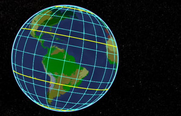
Polar regions – That part of the earth’s surface above 60° N and 60°S latitude. Includes the north and south poles as well as the Arctic Circle (66.5°N) and Antarctic Circle (66.5°S) The yellow lines near the poles.Mid-latitudes – That part of the earth’s surface from 30°N to 60°N and 30° to 60°S latitude.Tropics – That part of the earth’s surface between 30°S and 30°N latitude. Includes the equator (0° latitude), the Tropic of Cancer (23.5°N), and the Tropic of Capricorn (23.5°S). The yellow lines near the equator. |
|
Figure 1 – A view of the western hemisphere taken from biome viewer. The colors on the continents represent the major biomes, which are in part defined by latitude. See the side panel for the figure above to see the major latitudinal sections of the globe. |
|
Investigation
Activity A – Examining basic climate data
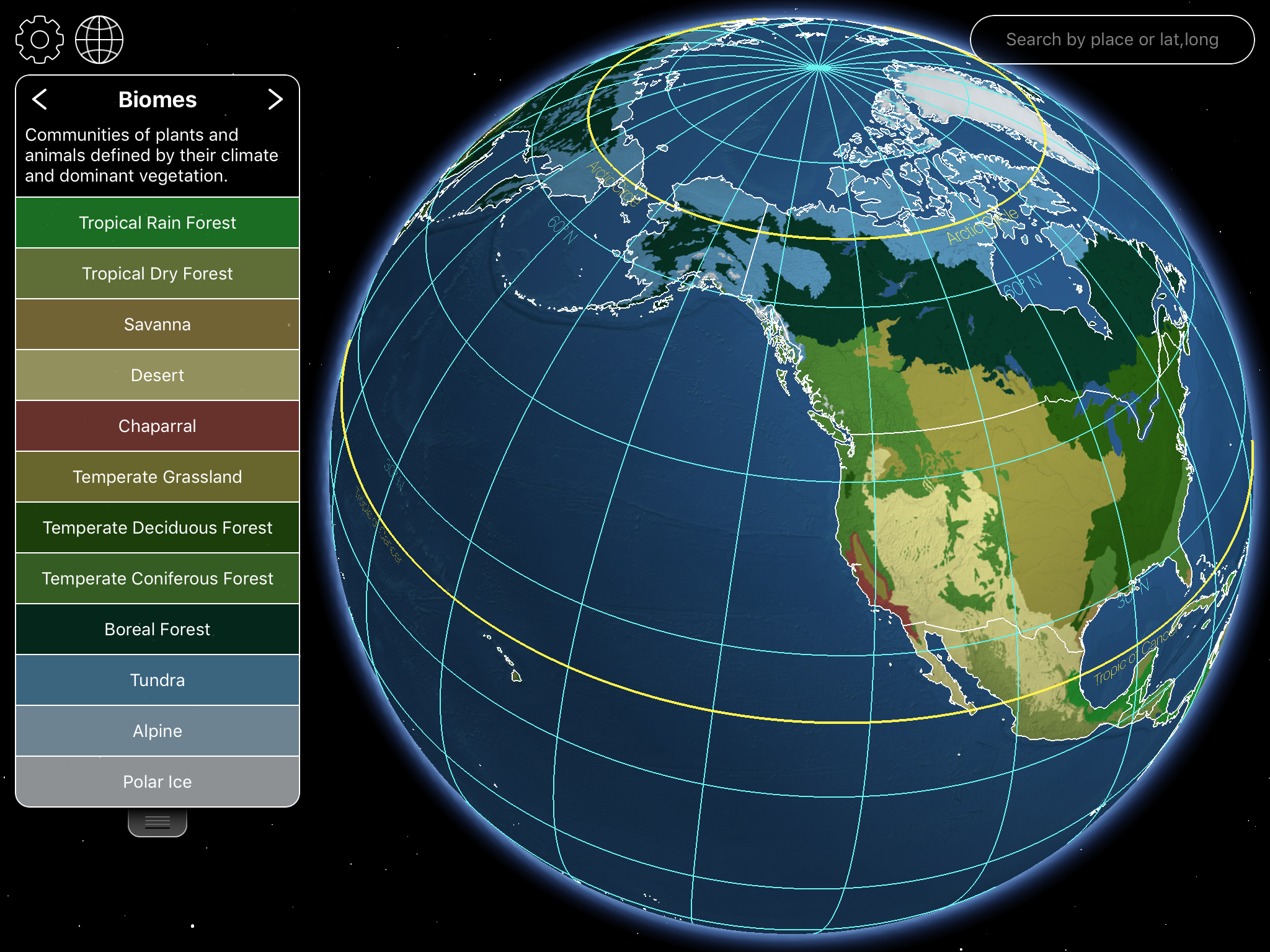
Launch Biome Viewer < http://media.hhmi.org/biointeractive/biomeviewer_web/index.html >. By default, you will be shown a rotatable globe that will enable you to access climate data and biome information for major areas of the globe (figure 2).
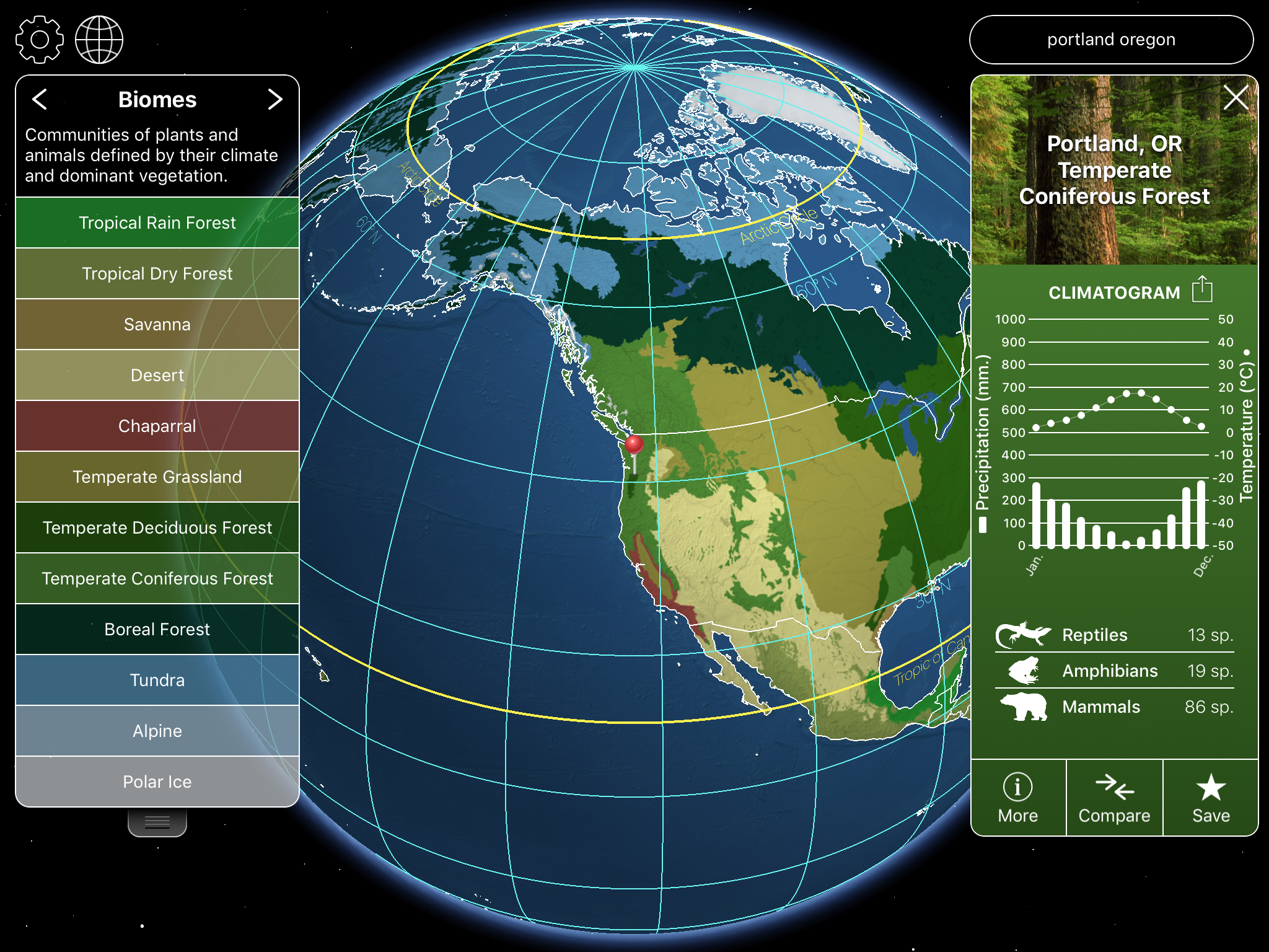
To do this click on the globe or type in the name of a city, state, or country in the search box in the upper right corner of the frame.
For this part of the activity, type in the name of the city you live in. Use the data panel that appears to the right of the globe (figure 3) to answer the following questions…
- What biome is the city in?
- What is the maximum and minimum monthly average temperature?
- What is the average annual temperature?
- What is the maximum and minimum monthly precipitation?
- What is the total annual precipitation?
|
|
|
|
Figure 2 – Default screen for Biome Viewer. The panel to side of the globe lists the major biomes of the planet. Click on any of the labels for a brief description of that biome. |
Figure 3 – the Biome Viewer screen with a station data panel visible on the right side of the globe |
Activity B – Gathering information about biomes and Climate zones
Begin this part of the activity by selecting a country and typing its name in the search box. The program will display this country with a virtual “stick pin”. Once it does, use the map of the country to answer the following questions….
- What biomes are present in the country?
- What plant communities are present in each biome?
- What is the climate of each biome?
Activity C – Examining the global distribution of climate zones
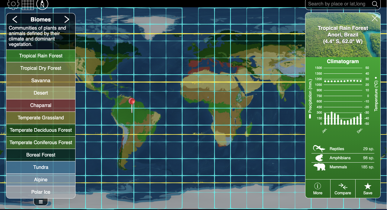
In this part of the activity you will be looking at how latitude and elevation impact climate. Begin by selecting “Biomes” from the menu on the right. Then flatten the globe into a map by clicking on the grid symbol in the upper left.
|
|
Figure 4 – Biome Viewer in a flat map mode. Make sure the grid lines are on for this activity. These can be turned on or off using the settings menu in the upper left corner of the map (look for the gear symbol). |
Use this map to answer the following questions….
- What biomes are in the tropics? What are the general climatic characteristics of these zones and what is the major type of vegetation found there? The tropics is the area between 30°N and 30°S.
- Which of the climate zones you identified in question 1 is shaped largely by elevation?
- The area between 30°N and 60°N, as well as the area between 30°S and 60°S are called the mid-latitudes. What biomes are found in these latitudes? What principle types of vegetation are found in each and what are the general climatic conditions in each?
- The area above 60°N and above 60°S are the polar latitudes. What biomes are found here and what are their climatic conditions and major vegetation types of these biomes.
